After escaping busy London and the south east, this route uses quiet, scenic roads where possible, but also some carefully chosen stretches of the A4 where the quieter roads become too circuitous. There are only a few serious hills, but the distance of about 225km (140 miles) is significant for a day’s riding, especially if the headwind is prevailing!
I have ridden this on four occasions and it has taken about `10 to 11 hours riding time (at 20 to 22kph moving average), plus about 2 to 3 hours of stops.
Links below are to the route description in a PDF file and a GPX file of the route as ridden in June 2017. In case of conflict, the description should generally be preferred over the GPX – but it’s up to you to take appropriate care when navigating!
London to Bristol – LBR – Route Description – v1.2
London to Bristol – LBR – v1.1
And here is a version of the route description laid-out with four columns per A4 page, which is handy if you want a print out to attach to your handlebars or top tube (but please be careful if reading whilst on the move!).
London to Bristol – LBR – Route Description – v1.2 – columns
An overview of the ride…
Heading across south London the route goes through Brixton then past Clapham Common and crosses the Thames for the first time at Richmond Bridge.
After tracking the river from Hampton and through Sunbury, we quickly escape suburban Surrey at Virginia Water and follow a gently rolling road into Berkshire.
Through Ascot town and past the racecourse, skirting round the south of Bracknell to pick up the road misnamed “Nine Mile Ride” (it’s actually 7 miles long these days). From here the route leaves the crowded south east behind and takes scenic rural roads through Berkshire, only mildly disrupted by the Aldermaston Atomic Weapons Establishment in the middle of a wood!
Just south east of Newbury is the lovely Woolhampton, where we cross the Kennet & Avon canal (and cycle path with surface unsuitable for road bikes). Then a carefully chosen stretch of the A4 to get through Newbury which is halfway to Bristol! After that lots of scenic countryside and thatched villages and criss-crossing the river Kennet.
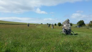
After Hungerford, with its cattle-gridded park, the route heads into Wiltshire, with various options for a lunch stop. After this the hills get a bit more serious as we head up the valley of the Kennet, through Marlborough and onto the Wiltshire Downs. Avebury standing stones are just a 1km detour, then back on the A4 for an exhilarating 3km descent into Calne.

West Kennet Avenue Standing Stones, Avebury
Between Calne and Bath the route crosses the southern edge of the Cotswolds providing the most challenging hills of the ride. The final stretch starts with the Bath to Bristol cycle path, which follows an old railway route across the Avon valley. Unfortunately the cycle path then takes a 5 mile detour to the north of Bristol, so we take a more direct route up a headwindy-hill into Hanham, then down to the Avon again and finishing at Bristol Temple Meads Station.
